Just noticed that NBN and BSBI plant distribution maps are currently not available. To be more accurate the BSBI maps are not available at all and the NBN maps seem to lack a lot of data. I was trying to find the distribution of Festuca rubra vs Festuca ovina in Cornwall incase there was any difference between the taxa but neither of these UK wide data systems seemed to have the full information. Actually tried a number of other taxa with similar results i.e. limited information and BSBI no maps.
I could of course contact the systems and find out what the problem is but for a general user they may think that there is either no data or that these very common taxa have a rather limited distribution in UK.
Interesting that there is a sudden complaint if these electronic systems are unavailable rather than trying to find a hardcopy atlas of the flora.
Finding a hard copy is not easy for everyone. If the library doesn’t have it then it’s Interlibrary loans and that takes time.
Consider using GBIF https://www.gbif.org/species/search
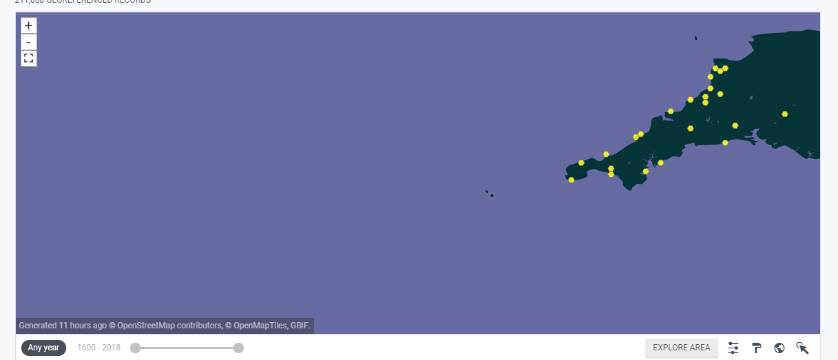
Appx 79 rubra in Cornwall
31 ovina
You can zoom in and interrogate individual records, it’s not easy to filter for a County but it’s good enough for smart comparison. Ignore the iNat Records!
Just make Cornwall the whole map (as best you can) then Click EXPLORE AREA - honest it’s better than NBN for most things.
I have been unable to log into the Forum most of the evening - does anyone else have problems?
this morning…may have been Chrome security settings
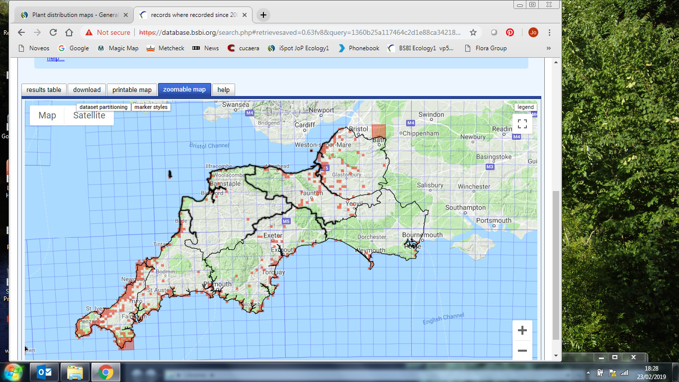
The BSBI maps page now says that they will be back on Monday.
(I have a hard copy of the distribution atlas, from a library sale, but I don’t use it - the BSBI maps give more recent data, at higher resolution. In general, immediate access, when a question arises, is much preferable to saving up a list of taxa to check out on the next visit to a library, if you can find a library that actually has a copy.)
the hi res BSBI is functioning as of this evening …
BSBI maps are currently not up for me. (Does @Jo_Parmenter have a different URL?) I’ve just looked at the 1962 Atlas - comparing site records with hectads records is not trivial, but I think that the Atlas shows a wider distribution in West Cornwall. If you search the GBIF datasets it seems that it has BSBI records for Scotland and Wales, but not for England.
However GBIF looks a lot better than when I last looked into it - it used to have rather patchy coverage.
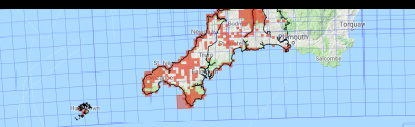
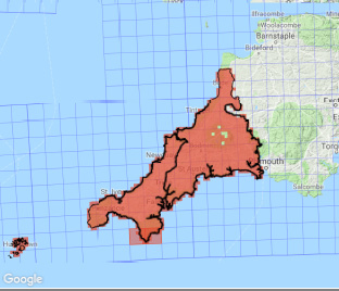
Trying Malva arborea as a different test taxon GBIF has good coverage of Wales (but at hectad resolution) and of Isle of Man at a better resolution, but is noticeably short of records for south west England.
I might have different access…will have a look at maps now and report back…
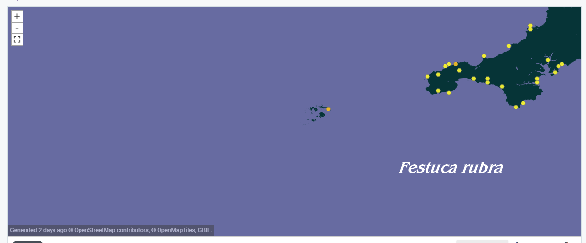
Festuca ovina 1806 post 2000 records
Festuca rubra post 8133 2000 records
-
more rubra than ovina; ovina more often in coastal grassland and uplands; rubra ubiquitous
-
number of records incudes duplicates
Malva arborea post 2000 - interesting distribution: seems to dislike N Devon.
Its all over the place in E Norfolk these days, incidentally
I see that the maps interface to the database works, but that the main maps page doesn’t (and has now lost its promise of a return by Monday).
Aren’t these records dependant of Local Recorders - which might explain the North Devon (and Dorset) syndrome seen above.
The difference in databases is astounding.
I now see that the majority of BSBI records don’t (apparently) reach the Portals (NBN or GBIF)
I wonder why
But my own County has over 300 thousand records, kept in a restricted Archive and not showing via NBN nor GBIF. It is thick with valuable records for researchers.
Some Orkney records (BSBI ones specially) get to the NBN Portal
All my records are submitted to the local record’s Centre and to a Regional one which regularly updates to NBN.
Of interest, perhaps, is that the Col Dictionary has been updated for 2019 http://www.catalogueoflife.org/col/ it’s a very useful check on up-to-date names
The records ARE dependant on local recorders - but we are right at the end of a massive push to get data in for the 2020 atlas and unless someone is sitting on several years worth of data, I think a gap in N Devon is likely a real gap (the local recorder is no slouch, btw!)
PS - discussion is ongoing as to whether BSBI data should go to NBN and if so at what resolution. While data sharing is usually a good thing, there can be issues with certain of the rarer plant species, and in many cases, when we go out and collect data for the BSBI, the private landholdings we visit have agreed that data from their site can go onto the BSBI database, where high resolution records are made available for very specific purposes, but might not be as happy for that data to be widely available to everybody. A secondary issue is that BSBI data is very carefully checked and curated, and if you see a plant was growing in a certain area, you can be 99% certain the record is correct. If you then mix that dataset up with another which is, not verified in the same way, you can end up with misunderstandings about species rarity and distribution that can actually cause serious issues, for example in development planning “oh it doesn’t matter if we squash it as its really common round here” - well… actually, no. it might be very rare indeed, but the records have got muddled up with those for something which is much more common and an incorrect impression might then be formed. Its a massive can of worms…
yes, thanks. The BSBI recorder here (Orkney) is very careful over these things. All of my plant enquiries (and records) go to him.
The 2019 COL is a personal delight… my ids of Pulmonaria australis are now legitimised… happy days.
http://www.catalogueoflife.org/col/search/all/key/Pulmonaria+australis/fossil/1/match/1