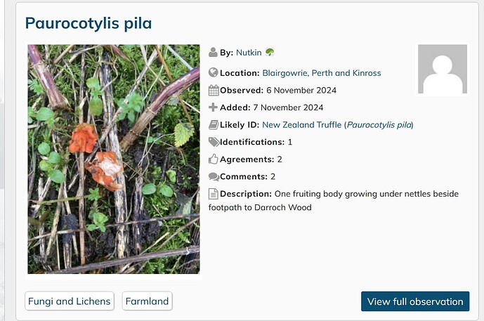
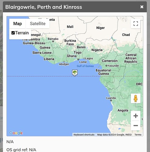
Looking at the “UK and Ireland - Observations” list I clicked on the location name for an observation (which is a link) hoping to find where the species had been observed. I was rewarded with a blank blue map with a group icon in the middle of it. This was repeated when I tried the same thing with a selection of random observations. In each case, opening the observation revealed the correct map.
I had the same issue a couple of days ago (recorded in the thread “S l o w…”).
Possibly (probably?) related problems but you seem to have met a problem accurately locating an observation as you entered it; I was finding a blank map when looking at previously entered observations.
There certainly does seem to be a long-standing problem relating to the link(s) between iSpot and the external mapping sites and I know a lot of work has been done on this in the past. I’m not expecting - or looking for - a quick fix but unless we draw attention to problems as we find them we can’t expect them ever to be fixed.
Not sure how long it will take to fix. Google does quite often change how the maps work and how to connect to the service so can be a constant battle to keep up which is rather annoying given how much we pay to use the service.
Looking at this a little further, zooming out on the blank blue map shows it to be centred on 0°N, 0°E.
Another map issue:
I wanted to check the location of an observation - Paurocotylis pila | Observation | UK and Ireland | iSpot Nature
but (as is well-known) the map disappears from an observation if you try to interact - adding a comment in this case.
So, I went back to the list-view tab, and clicked on the location -
This opened a new tab (I’ve zoomed it out so that it is clearer):
I’m not sure, but I don’t think that Blairgowrie is quite that far south…
Yes we know about this issue and hopefully will eventually get round to sorting it out. You can get to the location in other ways, for example by opening the observation and looking at the map there


