Yes. we must spend time on the GPS in the working location before using it to record. I often walk away from the Phone and return. I sometimes rotate and rock the phone. I often test a location within a few meters just to see how it is behaving.
There are very accurate compass and altimeter Apps, they too need rock n’ rolling, I have found.
My pace-counter App is very accurate and sometimes useful.
My car-driving phone app. is remarkably accurate (on the road)
I have stopped using my Garmin locator for iSpot
Modern units which can take signals from several constellations of satellites (EGNOS, Galileo, GLONASS etc as well as the original GPS) seem to do better. Perhaps this is a function of their being more likely to a wider range of satellites in view at any given moment.
GPS Accuracy: HDOP, PDOP, GDOP, Multipath & the Atmosphere - GIS Geography(geometric%20dilution%20of%20precision,more%20precise%20it%20can%20be. is a pretty easy read for anyone interested in learning a little more about GPS accuracy.
Interestingly my original unit (now >20 years old and still working) acknowledges its inaccuracy and displays an Estimated Position Error - often around 36ft/10m. That feature seems to have been dropped from later receivers from the same manufacturer. This may be partly justified because of improvements in the instruments but it also removes a useful reminder of the possibility of errors.
Yes that paper gives a nice summary. For a more extensive read of various methods of locating things in the field then there is always https://besjournals.onlinelibrary.wiley.com/doi/full/10.1111/j.2041-210X.2011.00118.x
In the years leading up to writing that paper it looked as if sub metre accuracy might be achievable with phones eventually but this has not happened - the accuracy has not improved much at all. There are a bunch of reasons for this but I would not hold my breath for much improvemtent in future either as there may be lots of vested interests in it not improving.
Triangles or error
Just to remind you that whilst we are talking here, there lies hundreds of Observations FAR from their proper location.
Not all these are birds, there’s snakes, butterflies, fungi and trees
Some are from really trustworthy sources (apologies Paul!) https://www.ispotnature.org/communities/global/view/observation/822434/
It really is time these errors were cleared from iSpot.
Some of these are easy to correct as the minus sign has been missed but others that have no location name may be impossible and may need deleting.
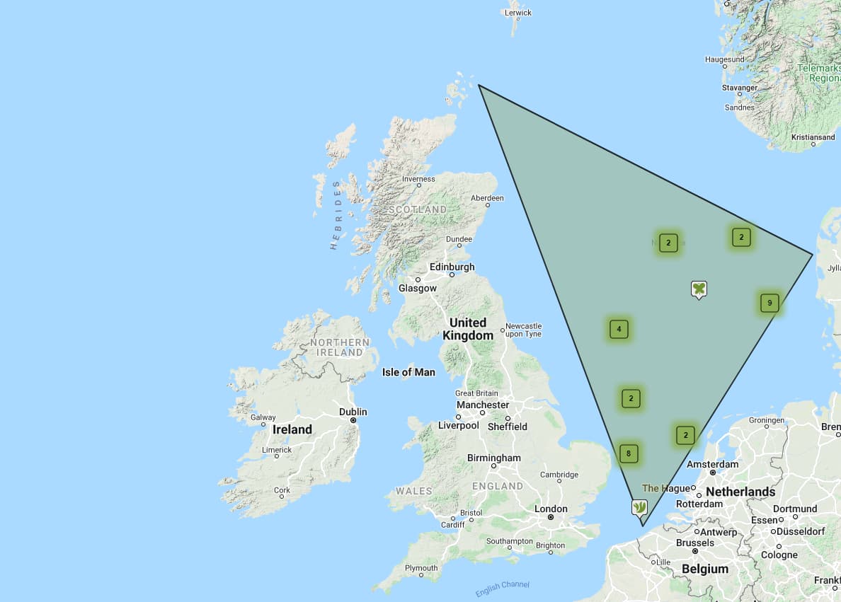
Here’s another 540
That’s unusual coming from you.
We get the original location by iteration…
We look at Observations by the User on the same day and use that.
We look at the User’s Observation map and use that
YOU look at the registration details and use that
we look for suitable location where there are Other Obs of the same and use that
I have done all of those things in submissions to you (except No4)
Simples
Is it possible that at least some of these were given locations to the nearest 10km and that iSpot has plotted them as points rather than as areas?
It highlights the point that the location problem has two sides to it: the reporter and the user, either or both of which can cause problems.
Yes but even with all those tricks there are still some that can’t be shifted to ‘correct’ place. Do you remember in the good/bad old days when Tony and myself (some of which was before I was curator) used to spend the Christmas/New year period fixing very large numbers of observations mostly due to location errors.
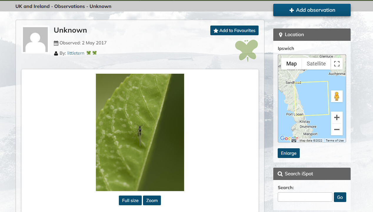
That might explain why if you zoom in the observations break up into more than one location. On the other hand, I looked at the smallest cluster (of 4), and the written locations were Ipswich, North Yorkshire, “Cwmbiga, Staylittle, Llanbrynmair” (probably can be located precisely) and Wirral Country Park.
Considering that a huge% of observations are not very location-refined, the nearest OS grid square, (not in a housing estate or a lake, say), will surely suffice.
Nearly all of them have Text Locations above the map
Let’s rid the project of the easy ones soon
https://www.ispotnature.org/communities/uk-and-ireland/view/observation/513937/
And @miked IF the location is not clear, then click the box Hide precise location - there are THOUSANDS of those. This user (example) was fond of that
I have recently taken to switching on the GPS location in my Olympus camera
The EXIF location data (NOT the date) is uploaded automatically when forming an Observation.
It is (usually) the most accurate GPS locator I have used, commonly to a metre or so on the Google Satellite location Map
Typically https://www.ispotnature.org/communities/uk-and-ireland/view/observation/842375/
Not exactly the same topic but I wonder if this website, which is map- rather than satellite-based, might be of interest to some:
.
https://www.cucaera.co.uk/grp/
.
I use it all the time, working from VC down. It gets you to the level of e.g. TM47156715, which is a building at RSPB Minsmere visitor centre. You can reach that point either by drilling down or by entering the grid ref in the search-box.
1 Like
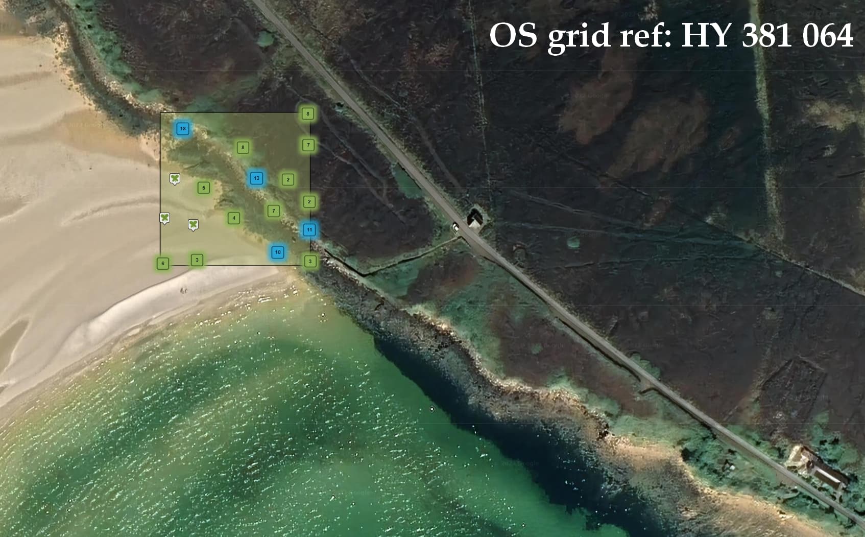
I have recently dusted down my precise-location Project
Here 100 x 100 x 100 - ORKNEY | Project | UK and Ireland | iSpot Nature
@Chris_Valentine The link above is broken, some links in my tracker were broken today
I have removed the suffix here but it still fails
https://www.ispotnature.org/communities/uk-and-ireland/view/project/746155/
Even pasted into my browser it fails
It can be found in the Personal Project Index under O where the link works properly.
App and camera accuracy seen here (Location)
https://www.ispotnature.org/communities/uk-and-ireland/view/observation/849073/
and 19th Aug
What Three Words
https://www.ispotnature.org/communities/uk-and-ireland/view/observation/849581/
I enter confirmed observations on iRecord where you can get down to 10 m square accuracy. I think that is sufficient for most purposes.