
There turns out to be 100km2 west of Kildonan where the newest record in the BSBI database is over 50 years old. It’s generally thin on the ground (absent?) on the high ground of the Scottish Highlands, particular Am Monadh Liath and Am Monad Ruadh.

If you play the game of zooming in to more and more detail on NBN atlas then there are indeed areas with no records. The chunk I have shown there is a bit of Orkney, a chance for a first record in a 10km square if anyone is listening who happens to live up that way.
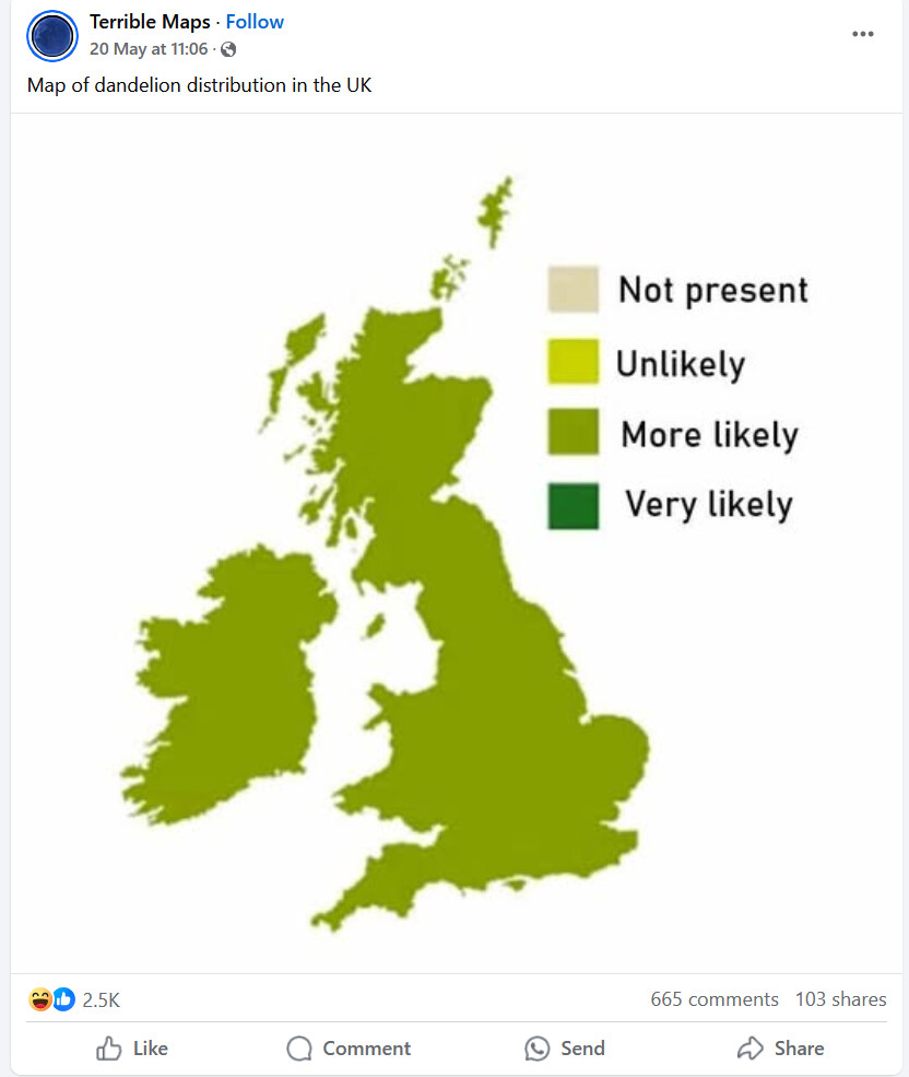
One thing it shows is that all of our observations are useful which may be the opposite of what ‘terrible maps’ are saying.
BSBI maps has records for every hectad in Orkney, but not every tetrad or every (small) island.
So you are saying the white bits on the NBN map I showed are just that the data on NBN is less than on the BSBI website? I think the map I put on actually shows 4 hectads with no records, it is tricky to say if it is 4 but quite possibly more than 2 just in this little area.
Where did the Terrible map get its data, and which taxon are we talking about? Genus Taraxacum?
I don’t know anything much about the site that produces these maps. This one just amused me, that’s all - it reminded me of my childhood, including the family gardening rivalries - where points were lost for caterpillars on the cabbages, or a rogue dandelion on the lawn.
This may be of interest:
BSBI data and the National Biodiversity Network (NBN) Atlas.
Sam Thomas writes in BSBI News Spring 2025 #159
“The BSBI has been involved with NBN since its inception in 2000. However, as anyone who has looked at the NBN distribution map for a common plants, with the exception of Scotland, the coverage is very patchy.”
Thomas describes the push to increase coverage (starting 2015) and the current situation. Thomas deals with “Why should BSBI recorders share their data with the NBN Atlas?”, “What data do we currently share with the NBN Atlas?” and “The future”.
There is a map (figure 2) of Vice-counties in the UK that are sharing their data with NBN Atlas where some are shown as full capture, those with restrictions applied (an option for sensitive or confidential data) and some not sharing.
BSBI are hoping "to share more in the future, especially the most invasive non-native species in Britain & Ireland to help with eradication and control."
Being mindful of copyright, I have given just a few extracts.
data sharing seems to be very territorial. I usually send my bird records to the Surrey Bird Club but I recently discovered that the SBC doesn’t share its records with Surrey Biodiversity Information Centre. I don’t know anything about the politics of this but I’d have thought that it would be in everyone’s interest to make wildlife data available. (I sent 70,000 of my Surrey bird records and perhaps 2,000 iRecord records {which they don’t get either} to SBIC - which is, of course, a drop in the ocean.)
Local records centres present themselves as part of the conservation movement but they can also be viewed as small businesses which expect to be given their raw materials for free. A formal agreement would be needed between, say, a bird group and the LRC. In my experience the LRC will want restrictive clauses such as the data donor won’t give their records to anyone else. And one county recorder found that what the LRC meant by data-sharing was only in one direction.
That may be true, John. I don’t know. But I do know that SBC charge planning people for their data.
(I like the title of this thread, by the way.)
The issue about paying for data is a big one. I have been to many meetings where LRC people say they have no money and the only way to get money is to charge for the data which is given to developers and similar but with advice too.
That explains why they wouldn’t want to give their data to the LRC. The planning dept would be able to use the LRC as a one-stop shop and the SBC wouldn’t get any remuneration.
(I can’t take credit for the title - it is Amadan’s.)